
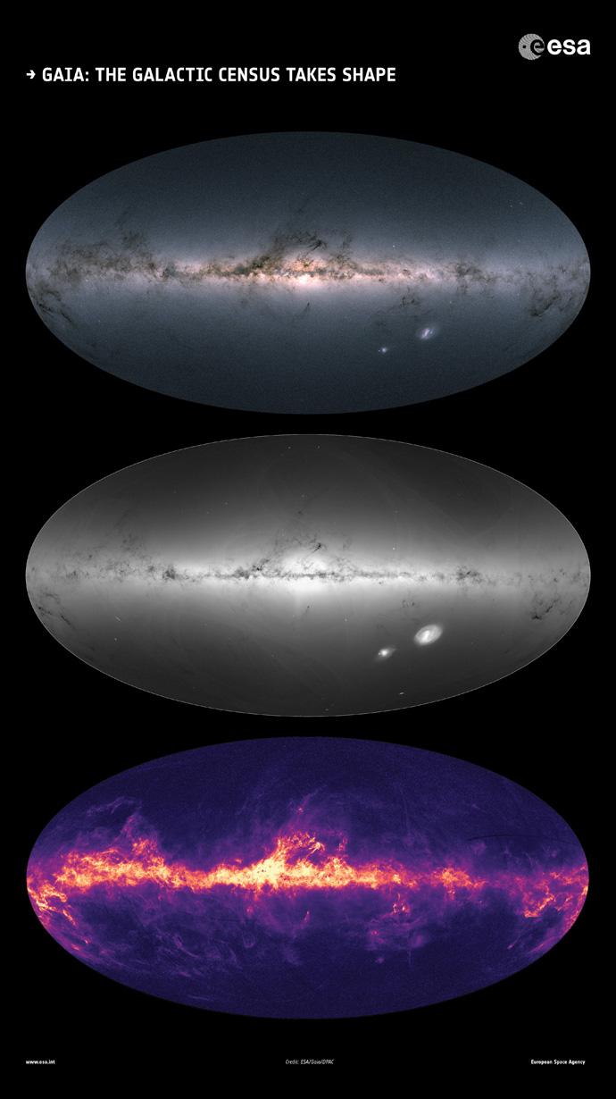
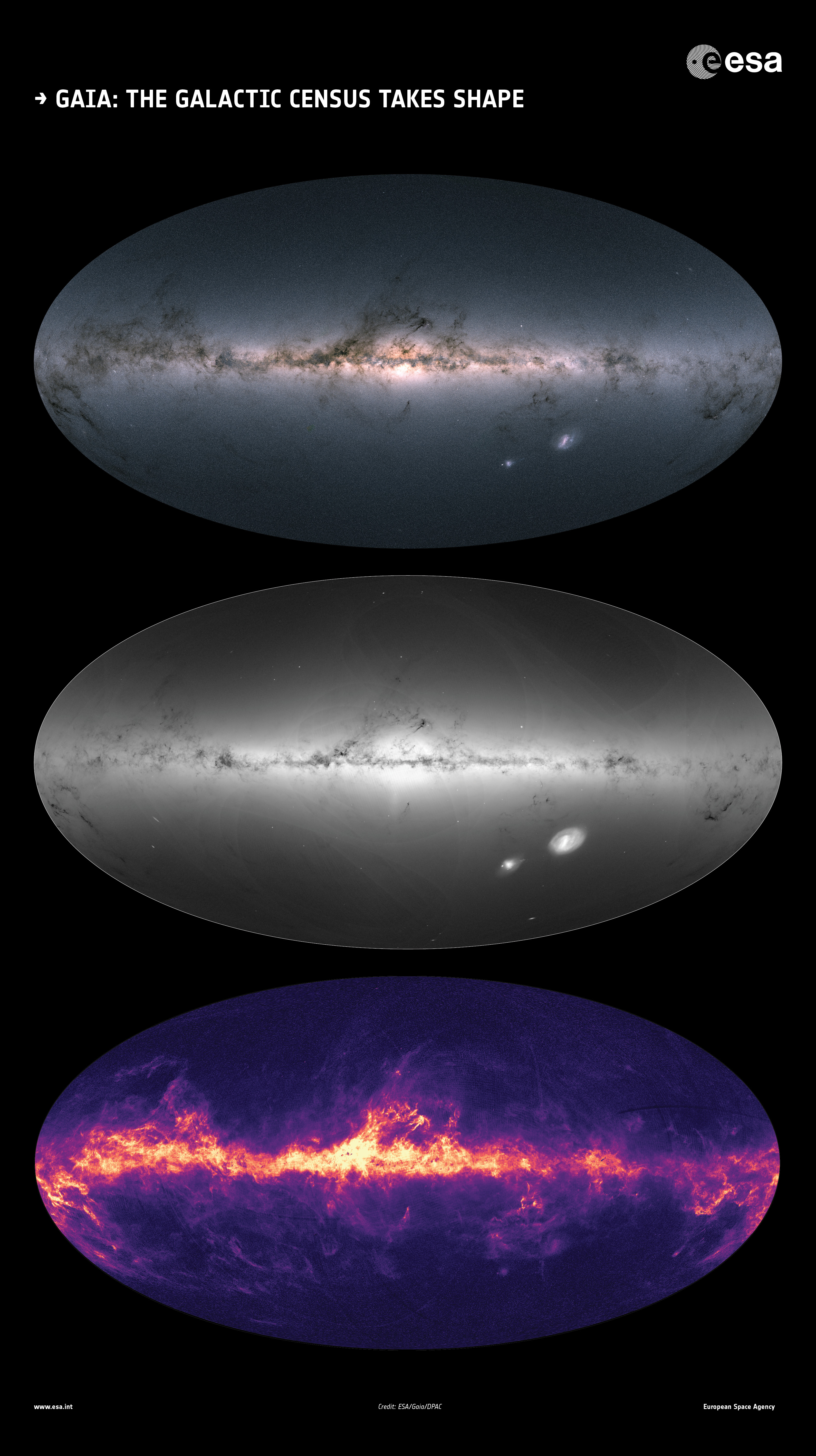
Gaia's all-sky view of our Milky Way Galaxy and neighbouring galaxies. The maps show the total brightness and colour of stars (top), the total density of stars (middle) and the interstellar dust that fills the Galaxy (bottom).
These images are based on observations performed by the ESA satellite in each portion of the sky between July 2014 and May 2016, which were published as part of Gaia's second data release on 25 April 2018.
Download larger image:
- 718 x 1280 (JPG, 534 KB)
- 3179 x 5669 (JPG, 2.94 MB)
Acknowledgement: Gaia Data Processing and Analysis Consortium (DPAC); Top and middle: A. Moitinho / A. F. Silva / M. Barros / C. Barata, University of Lisbon, Portugal; H. Savietto, Fork Research, Portugal; Bottom: Gaia Coordination Unit 8; M. Fouesneau / C. Bailer-Jones, Max Planck Institute for Astronomy, Heidelberg, Germany.
Page last updated: 29 May 2018